This post is also available in:
简体中文 (Chinese (Simplified))
Singapore Mass Rapid Transit (MRT)
Singapore is a small-but-highly-developed island nation located just off the southern tip of Peninsular Malaysia in Southeast Asia. The country gains its traction as the highly developed country in Southeast Asia with one of the world’s strongest economies where many foreigners come to Singapore to set up business. Despite its size, Singapore boasts one of the countries with efficient transport system due to its systematic, extensive, and comprehensive network of roads.
A Brief History of Singapore’s MRT
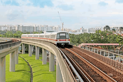
The MRT in Singapore has come a long way. It all began when city planners proposed a rail-based transport system in 1967. By the early eighties, despite all objections (due to high cost and labour shortage), the decision to build a rail-based transport system was finally made in May 1982.
The proposal of building of MRT was underpinned by the Comprehensive Traffic Study in 1981. The study showed that an all-bus system in the country was not practical and efficient. However, a mass transit rail system would have a tremendous influence in shaping the economic growth and development of Singapore. In this light, the construction of MRT started shortly at Toa Payoh and Novena after a ground-breaking ceremony held at Shan Road on 22nd October 1983.
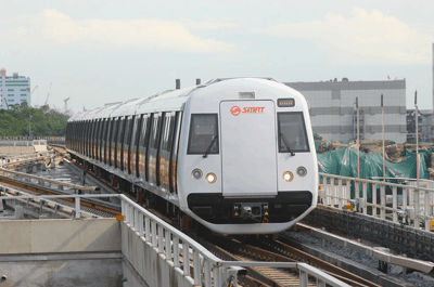
The MRT Lines & Stations
- The North-South (NS) Line
As the first MRT line in operation, the NS Line connected the city to the residential towns of Yishun, Ang Mo Kio and Bishan. Officially opened on 7th November 1987, the 5-station section between Yio Chu Kang and Toa Payoh was then extended to Raffles Place one month later and the Yishun and Marina Bay stations were added by the end of 1990. The second phase of the NS Line development completed in February 1996, connecting Yishun to Choa Chu Kang and a continuous loop to the branch line of the East-West (EW) Line was then being established.
- The East-West (EW) Line
The first section of the EW Line consists of two interchanges (City Hall, Raffles Place) and two stations (Tanjong Pagar, Outram Park). It was officially opened on the 12th December 1987, about one month after the launch of the NS Line. It expands rapidly to Lakeside and the eastern section (that linked City Hall to Tanah Merah) completed by early 1990.
- The North East (NE) Line
First started its operation on 20 June 2003, the North East line connects central Singapore with the north-eastern and western parts of the city-state. It extends from HarbourFront MRT Station in North East Singapore to Punggol in the north-eastern part of the country. The North East line is 19.2 KM long and has 16 stations. More than 600,000 commuters ride the route every day.
- The Circle (CR) Line
The Circle Line has 30 underground stations and is 35.5 KM in length. It runs from Dhoby Ghaut and Marina Bay in Central Singapore to HarbourFront in the South. Well, the CR Line was constructed to make it convenient for the public to travel between eastern and western Singapore, and it has done its job. According to Straits Times, 398,000 used this line every day in 2015.
- The Downtown (DT) Line
The Downtown DT Line was built in three stages as an extension to the Circle Line. The first stage was completed on 22 December 2013, and the later two followed two years apart, each after one another. Stage 2 was done on 27 December 2013, and stage 3 on 21 October 2017. The line is 41.9 km long and connects the north-east to the east, running from Bukit Panjang to Expo. Starting in Bukit Panjang, Downtown Line takes its passengers through the school district, Bukit Timah and Little India. The ride continues from there, and there are stations at Bugis, Chinatown and the Central Business District. Finally, it goes through Kampong Ubi and Kaki Bukit ending at Changi Business Park in Eastern Singapore. There are 34 stations.
- The Bukit Panjang (BP) LRT
The Bukit Panjang (BP) LRT Line has been operational for quite a few time now, first being open in November 1999. The line is 7.6 KM long and runs from Choa Chu Kang Station to Senja station in 90 Bukit Panjang Ring Road. There are 11 other stations between them (total 13). The Bukit Panjang line is the first fully automated train line in Singapore. There are two services, one which moves clockwise and another anticlockwise. About 62,000 people travel through this line every day.
- The Sengkang (STC) LRT
The Sengkang LRT line connects Sengank’s residential districts to Sengkang Town Centre in the North-East part of Singapore. The line is 10.7 KM long. There are two loops in the railway – the East and the West Loop. They were open on January 2003 and January 2005 respectively. The train line has been going continual renovations and improvements since the date of its establishment. As of now, it is fully elevated and automatic, and uses two-car trains.
- The Punggol (PTC) LRT
The Punggol LRT line opened on 29 January 2005. It connects the suburbs of Punggol to Punggol Town center. It is 10.3 KM long and has 15 stations. This line also has two loops, the East and West, with the latter coming recently in operation. The West Loop was only established on 29 June 2014, which is nine years after the Eastern one. As of now, there are 14 stations in the rail line, and there are four services, two on each loop.
Future Lines
- The Thomson-East Coast Line
The Thomson-East Coast line is the first on our list of the train lines currently under construction in Singapore. It is 43 km long and will start in the north at Woodlands town, passing through Ang Mo Kio and Bishan, Thomson and Stevens and Orchard Road and Marina Bay. The line will eventually end at the Upper East Coast. The Thomson East Coast Line has been expected to come under operation later this year in 2019. However, there are going to be six other stages of the construction, each one opening a year after from the previous one excluding the final extension up to Changi Airport, which is a long-term plan for 2040. From this data, we can say that the present project will be complete in 2025.
- The Downtown Line 3 Extension
The Downtown Line 3 Extension is expected to be completed by 2024, which will join Downtown Line 3 to the East-West and the under-construction Thomson-East Coast line. The length of the extension is 2.3 km. The government expects the Downtown Line 3 extensions to be of a great benefit to Singaporeans. This applies especially to Marine Parade Residents, who will be able to travel to as far as Tampines in only about 25 minutes. Currently, it takes them more than 40 minutes on average by bus.
- The North East Line Extension
The North East Line Extension is another on-going project. The project was announced on January 17, 2013, and is expected to be completed by 2030. The 2-kilometer extension will run from Punggol through the north part of the city to Punggol downtown. The construction started in 2018. According to the Land Transport Authority, the railways will help turn the area into an attractive live-work-learn-play environment for everyone, including residents, workers, and students.
- The Circle Line 6
The Circle Line 6 is the latest extension to the Circle (CR) Line. The construction of this 4-km rail line went to full swing in April 2018, and we expect it to complete in 2025. The track will be connecting HarbourFront Station to Marina Bay Station, and the officials are building three stations in Keppel, Cantonment and Prince Edward Road. We can say for sure that this circle line extension is going to be of massive help to people, providing a direct route between areas like Pasir Panjang and Kent Ridge.
- The Jurong Region Line
The Jurong Region Line will be the seventh MRT line in Singapore after the first stage of its construction in 2026. Builders will continue working on this 24km line until 2028, as it will open on three stages, the second one being on 2027. The line will serve the Jurong area, which is the south-western point of West Singapore. It will start from Choa Chu Kang, passing through Boon Lay and Tengah, eventually crossing the territories of Jurong. There will be 24 stations in the railway.
- The Cross Island Line
The Cross Island Line is an upcoming high capacity line, which will have a length of 50 km. This line is going to be the longest fully underground line in Singapore after its completion. We can expect it to come into operation in 2030. The Cross island line will serve the Eastern, western, and North-Easter part of Singapore. It will commence from Changi, spanning to and from Loyang, Pasir Ris, Hougang, Ang Mo Kio, Bukit Timah, Clementi, West Coast, and Jurong. There are going to be three phases of this construction.
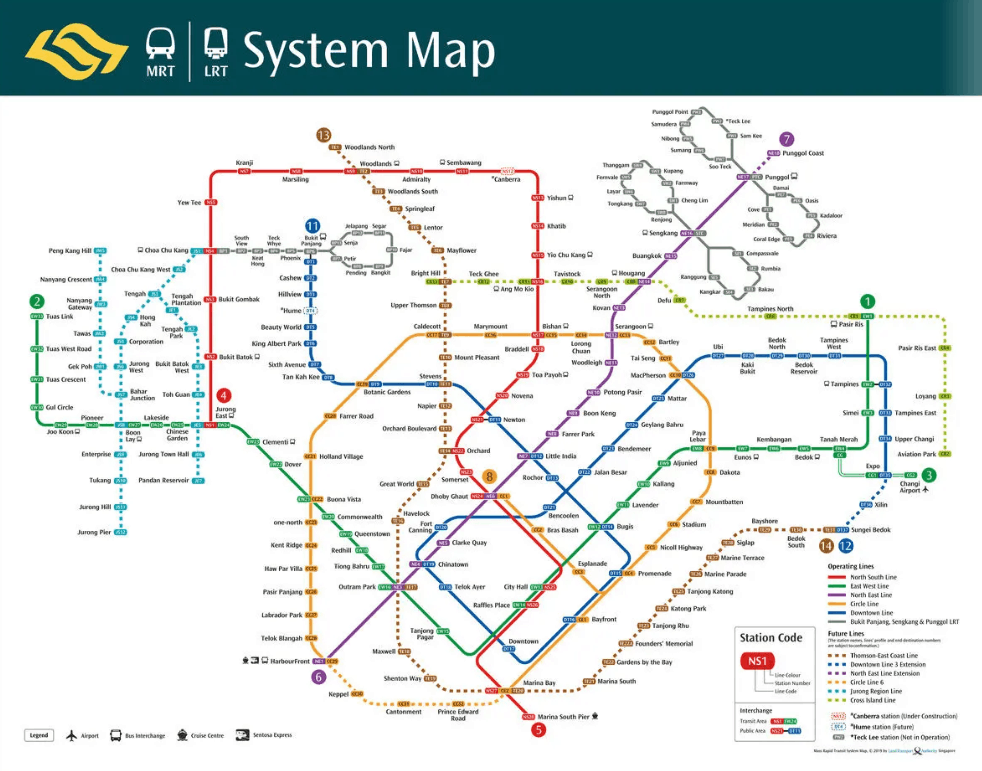
The Map of MRT
When you look at the map of MRT, you will find yourself looking at lines with different colours. The colour codes of the MRT Lines have come a long way – it evolved from NS Line’s red-yellow band and EW Line’s blue-green to red (NS Line), green (EW Line), purple (NE Line), orange (CC Line) and blue (DT Line).
In summary, they are:
- Red – North-South (NS) Line
- Green – East-West (EW) Line
- Purple – North-East (NE) Line
- Yellow – Circle (CC) Line
- Blue – Downtown (DT) Line
Once you get the hang of it, you can travel around the island in a breeze.
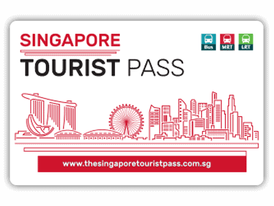
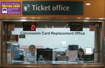
You can buy the cards at the TransitLink Ticket Office at the MRT stations (Orchard, City Hall, Raffles Place, Bayfront, Tanjong Pagar, Harbourfront, Chinatown, Farrer Park, Changi Airport, Bugis, Lavender, Jurong East, Kranji, Woodlands, Ang Mo Kio) or at the Concession Card Replacement Office at Somerset station. Click here to compare the different types of Singapore Tourist Pass.

TransitLink Ticket Office at the MRT Stations

+ Ticket Office will be closed for meal break from 1400 to 1500 hrs
# Ticket Office will operate on Friday only, from 1230 to 2000 hrs on STC Normal Race Days and from 1230 to 2230 hrs on Night Race Days
## Ticket Office will operate from 1230 to 2000 hrs on STC Normal Race Days and from 1230 to 2230 hrs on Night Race Days
Note: Kranji Station Ticket Office will be closed at 1930 when there are no race(s).
Concession Card Replacement Office
- Admiralty MRT Station
- Bukit Panjang MRT Station*
- Ang Mo Kio Bus Interchange
- Buona Vista MRT Station
- Choa Chu Kang Bus Interchange
- Hougang Bus Interchange
- Jurong East Bus Interchange
- Somerset MRT Station*
- Tampines Bus Interchange
Operating Hours: 1000hrs to 1800hrs Daily, Closed on Public Holidays.
*Bukit Panjang and Somerset CCRO will be closed for meal break from 2pm – 3pm.


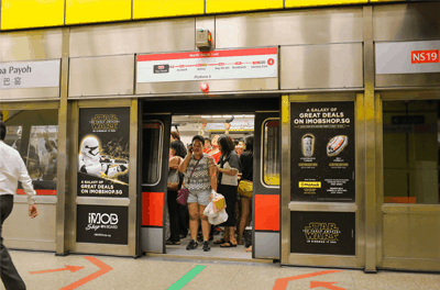 As the first MRT line in operation, the NS Line connected the city to the residential towns of Yishun, Ang Mo Kio and Bishan. Officially opened on 7th November 1987, the 5-station section between Yio Chu Kang and Toa Payoh was then extended to Raffles Place one month later and the Yishun and Marina Bay stations were added by the end of 1990. The second phase of the NS Line development completed in February 1996, connecting Yishun to Choa Chu Kang and a continuous loop to the branch line of the East-West (EW) Line was then being established.
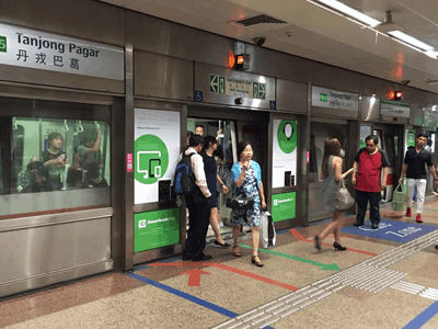 The first section of the EW Line consists of two interchanges (City Hall, Raffles Place) and two stations (Tanjong Pagar, Outram Park). It was officially opened on the 12th December 1987, about one month after the launch of the NS Line. It expands rapidly to Lakeside and the eastern section (that linked City Hall to Tanah Merah) completed by early 1990.
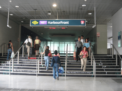 First started its operation on 20 June 2003, the North East line connects central Singapore with the north-eastern and western parts of the city-state. It extends from HarbourFront MRT Station in North East Singapore to Punggol in the north-eastern part of the country. The North East line is 19.2 KM long and has 16 stations. More than 600,000 commuters ride the route every day.
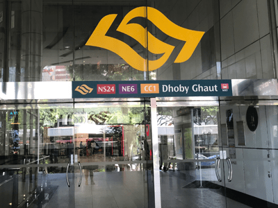 The Circle Line has 30 underground stations and is 35.5 KM in length. It runs from Dhoby Ghaut and Marina Bay in Central Singapore to HarbourFront in the South. Well, the CR Line was constructed to make it convenient for the public to travel between eastern and western Singapore, and it has done its job. According to Straits Times, 398,000 used this line every day in 2015.
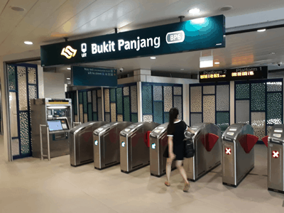 The Downtown DT Line was built in three stages as an extension to the Circle Line. The first stage was completed on 22 December 2013, and the later two followed two years apart, each after one another. Stage 2 was done on 27 December 2013, and stage 3 on 21 October 2017. The line is 41.9 km long and connects the north-east to the east, running from Bukit Panjang to Expo. Starting in Bukit Panjang, Downtown Line takes its passengers through the school district, Bukit Timah and Little India. The ride continues from there, and there are stations at Bugis, Chinatown and the Central Business District. Finally, it goes through Kampong Ubi and Kaki Bukit ending at Changi Business Park in Eastern Singapore. There are 34 stations.
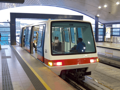 The Bukit Panjang (BP) LRT Line has been operational for quite a few time now, first being open in November 1999. The line is 7.6 KM long and runs from Choa Chu Kang Station to Senja station in 90 Bukit Panjang Ring Road. There are 11 other stations between them (total 13). The Bukit Panjang line is the first fully automated train line in Singapore. There are two services, one which moves clockwise and another anticlockwise. About 62,000 people travel through this line every day.
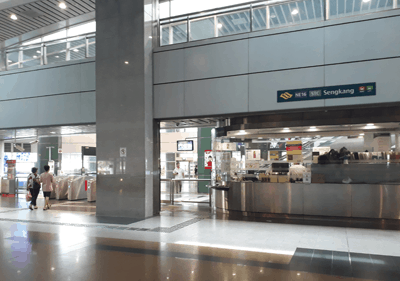 The Sengkang LRT line connects Sengank’s residential districts to Sengkang Town Centre in the North-East part of Singapore. The line is 10.7 KM long. There are two loops in the railway – the East and the West Loop. They were open on January 2003 and January 2005 respectively. The train line has been going continual renovations and improvements since the date of its establishment. As of now, it is fully elevated and automatic, and uses two-car trains.
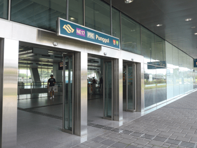 The Punggol LRT line opened on 29 January 2005. It connects the suburbs of Punggol to Punggol Town center. It is 10.3 KM long and has 15 stations. This line also has two loops, the East and West, with the latter coming recently in operation. The West Loop was only established on 29 June 2014, which is nine years after the Eastern one. As of now, there are 14 stations in the rail line, and there are four services, two on each loop.
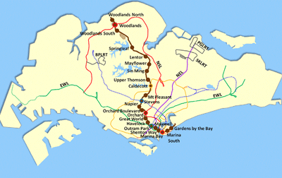 The Thomson-East Coast line is the first on our list of the train lines currently under construction in Singapore. It is 43 km long and will start in the north at Woodlands town, passing through Ang Mo Kio and Bishan, Thomson and Stevens and Orchard Road and Marina Bay. The line will eventually end at the Upper East Coast. The Thomson East Coast Line has been expected to come under operation later this year in 2019. However, there are going to be six other stages of the construction, each one opening a year after from the previous one excluding the final extension up to Changi Airport, which is a long-term plan for 2040. From this data, we can say that the present project will be complete in 2025.
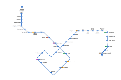 The Downtown Line 3 Extension is expected to be completed by 2024, which will join Downtown Line 3 to the East-West and the under-construction Thomson-East Coast line. The length of the extension is 2.3 km. The government expects the Downtown Line 3 extensions to be of a great benefit to Singaporeans. This applies especially to Marine Parade Residents, who will be able to travel to as far as Tampines in only about 25 minutes. Currently, it takes them more than 40 minutes on average by bus.
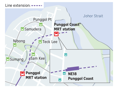 The North East Line Extension is another on-going project. The project was announced on January 17, 2013, and is expected to be completed by 2030. The 2-kilometer extension will run from Punggol through the north part of the city to Punggol downtown. The construction started in 2018. According to the Land Transport Authority, the railways will help turn the area into an attractive live-work-learn-play environment for everyone, including residents, workers, and students.
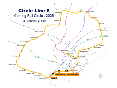 The Circle Line 6 is the latest extension to the Circle (CR) Line. The construction of this 4-km rail line went to full swing in April 2018, and we expect it to complete in 2025. The track will be connecting HarbourFront Station to Marina Bay Station, and the officials are building three stations in Keppel, Cantonment and Prince Edward Road. We can say for sure that this circle line extension is going to be of massive help to people, providing a direct route between areas like Pasir Panjang and Kent Ridge.
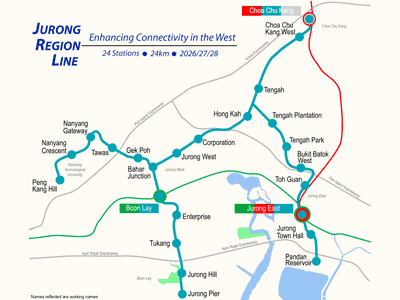 The Jurong Region Line will be the seventh MRT line in Singapore after the first stage of its construction in 2026. Builders will continue working on this 24km line until 2028, as it will open on three stages, the second one being on 2027. The line will serve the Jurong area, which is the south-western point of West Singapore. It will start from Choa Chu Kang, passing through Boon Lay and Tengah, eventually crossing the territories of Jurong. There will be 24 stations in the railway.
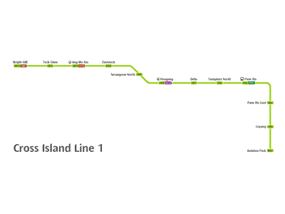 The Cross Island Line is an upcoming high capacity line, which will have a length of 50 km. This line is going to be the longest fully underground line in Singapore after its completion. We can expect it to come into operation in 2030. The Cross island line will serve the Eastern, western, and North-Easter part of Singapore. It will commence from Changi, spanning to and from Loyang, Pasir Ris, Hougang, Ang Mo Kio, Bukit Timah, Clementi, West Coast, and Jurong. There are going to be three phases of this construction.